Tag Archives: Travel

On the road

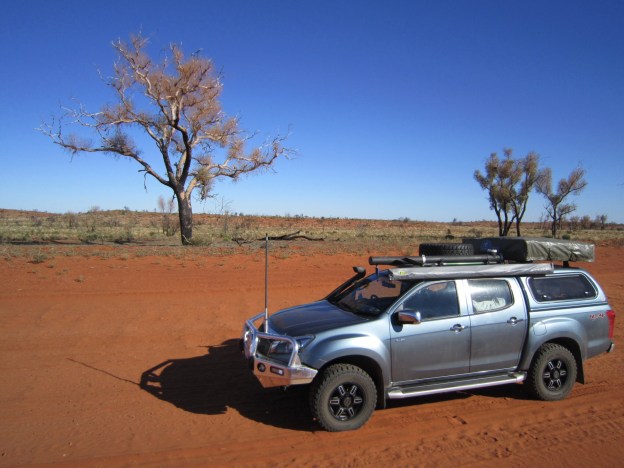
In the early morning twilight the shapes moving in front of me are vague and unformed.  I hear the excited squeals of my dog as she dashes forward, hurtling into the darkness.   I feel the ground shake. Thump thump thump.  A dark silhouette emerges from the shadows and a panting kangaroo bounds past, almost brushing my left shoulder.   A white blur and my dog follows at top speed.  I call into the mist as the day begins to break.  My heart pounds.  Not today…

Rushing to get ready for a long trip alters time.  Everything on your to do list takes longer than you expect.  But finally we are ready.  Dogs safely housed.  Chickens and cattle fed.  Last minute chores complete.  We drive away from the house.

Today we are leaving for Cape York.  We have arranged to meet with three pairs of our fellow travellers at 8 am.   The phone rings.  A breathless Suzanne apologises.  They will be delayed.

We arrive at the meeting point and are greeted by Howard and Beryl, our “tour leaders”.  Standing smiling beside them are our sending off party, Brett and Christine.  This time last year they were getting ready to leave with us.  Desert crossing companions, they will be greatly missed, but a last minute gift, a journal, means we will take them with us on our travels.

Brett and Christine sending off

We learn that Heather and Max, who were due to leave with us today are also delayed by a recalcitrant cow and calf.  We feel slightly lonely as two utes of the expected four pull away and leave Dean’s Marsh for Cape York.
Two Utes leave Dean's Marsh

Our home state of Victoria is wearing her winter clothes.  Pale grey clouds lie unmoving in the chill air.   Weak sunlight plays on paddock stubble.  I see sheep huddled together for warmth and comfort, their enviable woolly coats barely enough for this late May morning.

At Creswick a biting breeze rises as we hurry to find hot coffee and toasties to help ward off the wintry weather.

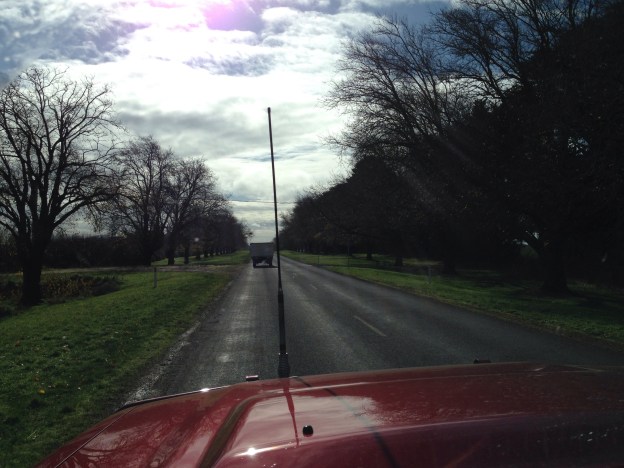
Leaving chilly Creswick, a long avenue of remembrance leads us on our way.  Each tree marked with the name of a lost son, father, husband, brother.  Falling leaves honour them with a shower of yellow, amber and gold.  Falling leaves for fallen lives.

Light grey and yellow limbs of gum trees embrace the road as it winds through well grazed paddocks to Smeaton and then to Maldon.

A popular day trip from the city, Maldon today is quiet.  Inside the oldtime shop fronts, sellers shiver in their darkened treasure troves.   Kitsch rubs shoulders with quirky modern.   (Poodle lamps anyone?) Gluten free cakes are on offer beside traditional pea and ham soup.   It’s said the best cream bun in the Southern Hemisphere can be purchased here.

Maldon poodle lamps

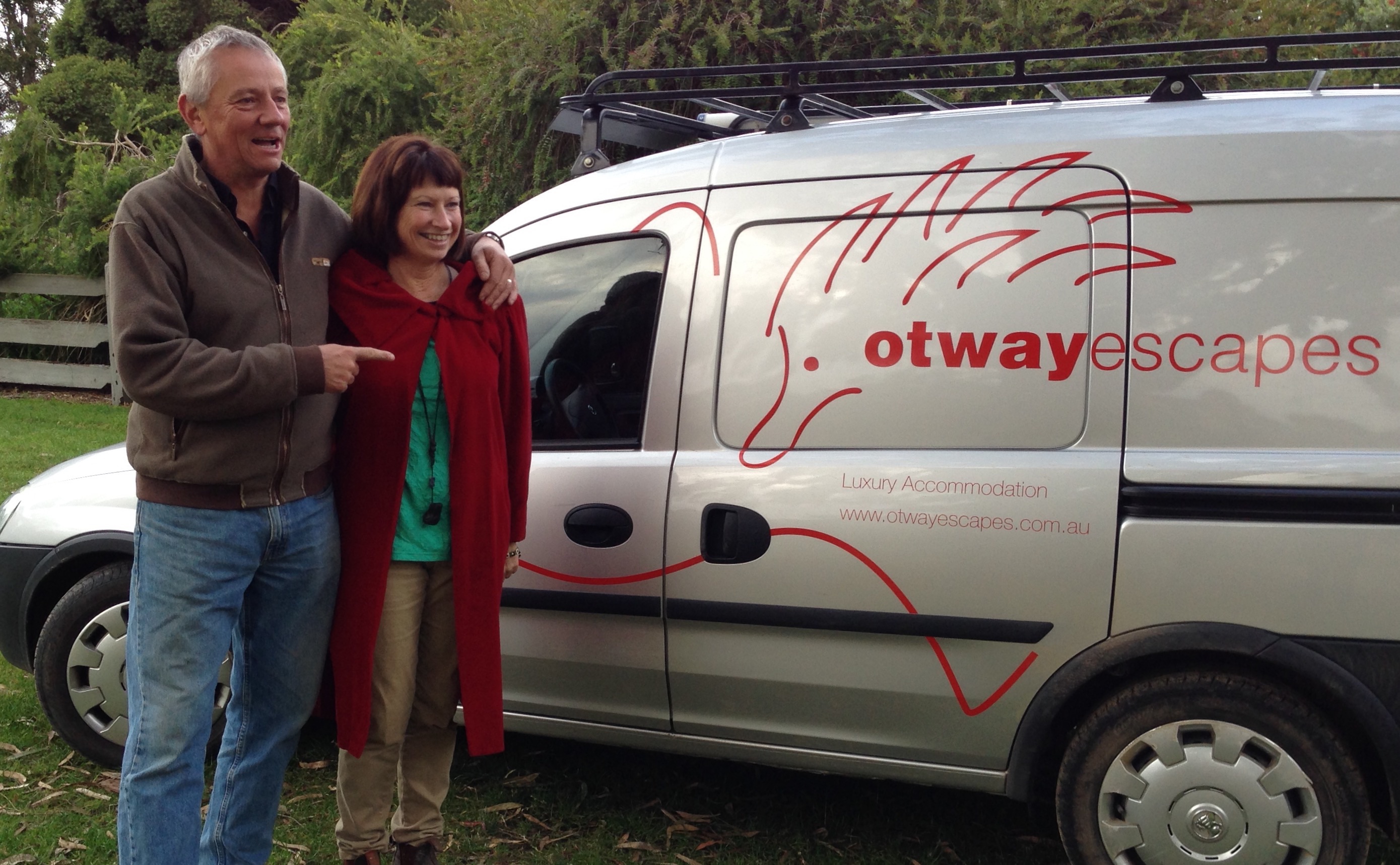
As we lunch, the sun breaks through.  Golden rays warm the street.   Shoppers slow their pace, stop to chat and enjoy the radiant heat while it lasts.  We see a familiar vehicle drive by.  They have arrived.   Dom and Suzanne join us and then there were three.

The road from Maldon passes properties belonging to independent spirited homesteaders.  A pig snorts and snuffles in the front yard.  Two donkeys graze in the garden.   Chooks cluck in backyard chicken coops.

Richard spots lovely old trucks by the score.  Oh what bargains he could find here.

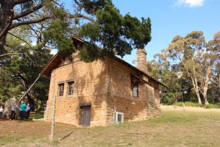
The land is changing.  Red and yellow ochre stains the banks along the roadside.   We are in goldfields country.   Ballarat, scene of the Eureka Stockade, passes by.  Her sister city, Bendigo, is a regal old lady.  She retains much of the grandeur of her bygone days.   Chinese dragon museums tell of the long history of Asian Australians hereabouts.  There’s gold in these hills.   Wealthy citizens built in stone to the glory of God, the Queen and their own success.  I wish we had more time to do this city justice.

As we drive out of Bendigo, a UHF radio exchange about the acclaimed Maldon cream bun is interrupted by a familiar wit.  Malcolm and Olive are nearby.   They tag along as we drive by and now, count the vehicles, we are four.  Yes, this is a convoy.

Cuppas on the riverside at Echuca give us time to catch up on all the news before we drive on to Deniliquin, our destination for today.   This is where we leave Victoria and cross the Murray River to New South Wales.   In NSW the roads seem wider and almost roman in their unwavering directness.   Easy driving.  We are soon in Deniliquin.  Deni Motel is the final stop for the day.

The local RSL is recommended for dinner by a policeman.  He stops to chat between random breath tests for passing motorists.  It does not disappoint.  Good food and an injection of funds for Beryl.   Two dollars wagered on the pokies produces a return of ten.  Take the money and run, we cry.

The busy days preparing for the trip catch up with us.  We retire early.   Heads hit pillows dreaming of tomorrow and the Darling River.

The long road north

Get out your map of Australia now.

We are going to Cape York.  How are we going to get there? Read on for the route of our long road to the north.

We like to go off the beaten track.   So rather then heading up the freeway to Melbourne from our home in the Otways, we’ll head inland through the goldfields and wool mills around Ballarat and Bendigo.   Two of our party will meet us on the way.  Five vehicles will then head north across the great Murray River to overnight in the country town of Deniliquin.

Taking a turning to the west, our camping convoy will head for the Darling River, one of the longest rivers in Australia.  Our journey along the Darling will take us through small towns like Wilcannia that were once bustling river ports.  Back in the river boat era, the Darling was part of an extensive water transport network that took wool and other goods to the coast.

Leaving the river for the outback, the convoy will visit the mining town of Lightning Ridge, famous for its black opals.   Then on to Roma, home of the largest cattle sales in Australia, if not the Southern Hemisphere.  We’ll spend some time there admiring the animals at one of their  famous outback cattle auctions.

After the excitement of the sales yards, we head into the wilderness of Carnarvon National Park in Queensland’s central highlands to bush walk, admire the birds and wildlife and be inspired by the indigenous art.

If time allows, Longreach will be our next stop.  Famed as the birthplace of Australia’s Qantas airline, there is much there to interest the aviation enthusiast.  Those more interested in Australia’s rural history, can wile away a few hours in the Australian Stockman’s Hall of Fame.

Northwards to Airlie Beach, where the cars and campers will be given a few days rest in secure parking.   Skipper and crew will head to Hamilton Island for a week to explore the beautiful Whitsunday Islands by yacht.   On the edge of the Great Barrier Reef, this is a perfect sailing spot, sure to please even the most nervous novice sailor (I hope).

Refreshed from our sailing adventures, it is onwards and upwards to Charters Towers, then along the Gregory Development Road to Cairns and on to Cooktown in the Cape York Peninsula.    It’s starting to get hot and steamy up here.   Cooktown sits on the edge of the tropical rainforest and is a botanist’s paradise, as well as a handy stopping off point for the Great Barrier Reef or the Lakefield National Park.

Now in one of Australia’s true wilderness areas, we’ll take the Peninsula Development Road towards the town of Weipa.  Looking out for crocs we’ll head up the Old Telegraph Track to the northernmost tip of mainland Australia, Cape York.   This could test our vehicles and our drivers. Its rocky creek crossings are spoken of in hushed tones by experienced off-road drivers. Gunshot Creek, the scariest of them all, requires a steep descent into a running rocky river. As the old timers used to say, “there be dragons…”

Having made it this far, we hope to have time to take the ferry across to Thursday Island.  The island is the centre of the Torres Strait Islands region, culturally Melanesian but administratively part of Far North Queensland.

And there, as far north as we can go, we will have reached our destination and can make our way slowly back home.

This is the plan.  Dear reader, do join us on our travel adventures to the most northerly tip of Australia.  Bigredbit will document what happens as the plan meets reality.


Off the beaten track

Don’t laugh.   This sketchy map is pretty much how I viewed Australia until I came to live here.  It’s defining features?   The big red sandy bit in the middle and the country’s incredibly deadly wildlife – snakes, sharks, spiders, poisonous jellyfish and man-eating crocodiles.  Its culture?  Cricket and beaches.  Beer and barbies.  Crocodile Dundee and Kylie Minogue.

Of course, it is more, much more than that.  Its vast, open spaces are mind expanding.  Its wildlife is unique and diverse.   Its indigenous culture ancient and mysterious.  Its written history, short, brutal and at times full of despair.  Turn off the beaten track and you begin to dig beneath the surface of modern Australia.

That’s why when we leave the green, pleasant land of Victoria and head north, we will steer inland, away from the major roads.  We will visit monuments to early settlers, old woolsheds, opal fields and outback cattle yards.  We will see the sobering effects of drought and enjoy the mateship of a country pub.  We will cross rivers, some running, some dry, as we make our way slowly northward to the tropical wilderness where the deadly predators still roam.

Off the highway, we may begin to understand a culture that celebrates heroic failures more vigorously than stoic survivors.   The tragic loss of the Gallipolli landings?  Honoured as a defining national event.  Bourke and Wills, the explorers who never came back?   Recognised by a bronze statue in the centre of Melbourne and better known than any who lived to tell the tale.

Modern Australia is a country built by victory over extreme adversity.  Off the beaten track, the human struggle to live on this harsh, parched continent is more apparent.   Think back through history. The urban poor of the British Isles, transported as convicts to a far off land, lacked the most basic agricultural skills to scrape a living from the land.  They almost starved.  New settlers, seeking gold or escaping political discrimination were little better equipped.  Tragedy was commonplace in the early days of modern Australia.  But still they came, looking for a better life.  Hoping to win against the odds.

Perhaps that’s why we celebrate the battler, the man or woman who will take risks and have a go, no matter the consequences.

Travelling inland we will hear their stories and see the land as they would have seen it.     Away from the hubbub of 21st century coastal city life, if we listen carefully we may catch the melody of their songs on the wind.

There is much more to Australia than its travel brochure reputation suggests.  Dig beneath the surface, leave the highway for a dirt track and discover another country.

The Artist’s Studio

The artist’s studio. A place to be creative.

A house plan these days will often include two or three bathrooms, a home movie theatre and a double garage, but very rarely does it consider the need for a special place for creativity.

I’ve been thinking about this since I visited Hans Heysen’s studio in Hahndorf in South Australia. Hans Heysen was an acclaimed artist, a German who settled in Australia. His stone-built studio is located high up on his sloping property, positioned perfectly to take in the view of the eucalypts and cedars in his garden. Clear daylight streams into the building through enormous windows that fill its south-facing wall.

Hans Heysen Studio

Hans Heysen Studio

The studio stands apart from the house where Heysen lived. Apart both by location and appearance. A national treasure, it is said to be the oldest artist’s studio in Australia.

So much love, time and money was spent on this building. The artist commissioned a local Hahndorf firm to build it, using raw materials from the area. He worked closely with a team of architects to perfect the design. The resulting studio is faintly reminiscent of an alpine lodge, but in sturdy local stone. It is a man’s building, solid and strong.

Inside, you can see it is more than Heysen’s workshop, more than somewhere to keep his tools of trade, his paints, charcoal sticks and brushes. The essence of the man is here. The house, it could have belonged to anyone.

Heysen loved nature. He loved painting the day to day agricultural activities in and around Hahndorf and was deeply inspired by the stark, majestic beauty of the nearby Flinders Ranges. He toured the area to find his subjects, deftly capturing light and shadows with his charcoals, drawing from life, outside in the open air.

Returning to his studio, he painted from the black and white preliminary drawings, reproducing by memory the fall of the light, the tints and hues of the natural world. His oil paintings document his time and his place, giving us a secret window into South Australian life in the early twentieth century.

Perhaps that is how creativity works. We live, we love, we travel. We see for ourselves the beauty and the dark horror of the world, then we return home to our special place, our studio, to interpret these experiences in our own unique way. In the process of creating something from our experiences and our emotions, we understand ourselves better and communicate more deeply with the people around us.

We can’t all build a self-standing studio, like Hans Heysen. We can’t all afford that luxury. But, a desk, a shed, a special corner of a room? That’s possible.

You might say you are not creative, not an artist. Think again. You might not use a paint brush, but your unique work may be produced with a welder, a camera, a garden trowel, a drum machine or a laptop computer. Creativity takes many forms.

How different would our world be if every house included a special place set aside solely for us to be creative? How different would our lives be if we valued art and creativity that much?

Build yourself a studio. Who knows where it might lead.

Red Sands and Salt Lakes

Here’s a missing post that was written on our second day in the Simpson Desert. It didn’t make it up on to the blog, so it’s a bonus for you today.

********

Refreshed from a night of deep sleep in the warm, dry desert air, we breakfast quickly and make an early start on the road again.

Once again we are making our way over and across the parallel waves of sand. The dunes rise and fall in front of us, creating a rhythm of their own. The rhythm is hypnotic, up and down, up and down. We become part of the song of the desert as we climb to the crest of each dune and then drop away to the trough. The note of the engine rises and falls as gears change. The drivers are focused, selecting the right gear, choosing the best track to make their way over the dunes. They cannot help but move to the beat of the desert’s song.

Lizard tracks

Lizard tracks

It is a beautiful song. Red sienna dunes rise from grey sandy troughs. Clawed tree branches clutch at the pastel blue sky. The colours change in time with the rhythm created by the shape of the land. Up and down, up and down. As we drive deeper into the desert, the colours grow more intense. The channels between the dunes are dotted with squat bonsai-like trees, yellow flowers in silvery grey foliage. The desert is beautiful but hers is a harsh environment. To survive here, plants must live in an arid sandy soil under the fierce glare of the sun. They defend themselves from dehydyration by growing a silvery armour on their leaves and holding on tightly to any water that falls, storing it within. Life in the desert is always on her terms.

Driving in the desert

Driving in the desert

We cross paths with a group of fellow travellers in Land Rovers. They have decided to ignore some of the desert park rules and are not pleased to be reminded of them. Live and let live, but safety must come first in the desert. You can lose your life here, or cause others to lose theirs.

As the the sun rises into the sky, the colours around us deepen. The sand blushes in pastel red and orange hues, complimented by the milky blue sky. And still the rhythm of the dunes beats on, up and down, up and down.

Desert flowers

Desert flowers

We lunch quickly, keen to make progress on our journey, impatient to rejoin the hypnotic rhythm. We drive on. In the early afternoon we come to the first of many salt lakes, empty estuaries that are part of the great inland water system that runs into Lake Eyre. Lake Eyre is fed by a network of channels and waterways that stretches all the way to the East coast of Australia and far to the North and South. It may be the last truly unregulated lake catchment system in the world. Water flows as nature intended, as it has for millions of years. For now, the salt lakes are dry and wait patiently for water to come. Salt has crystallised on the exposed surface of the lakes, forming a crisp white crust that is strangely reminiscent of an early fall of snow in colder climates.

The lakes break the rhythm of the dunes. They are flat and even. We drive across them with ease. The pure white of the salt contrasts with the red sand and sparkles in the bright sun light. Here and there the pristine salt surface of the lakes has been disturbed by the tyre tracks of errant drivers. Man leaves his mark.

The coloured sand flags on our vehicles wave to and fro as we drive around Lake Poeppel to Poeppel’s Corner where three state lines meet. We find the marker post and prove that it is possible to have your photo taken with one arm in Queensland, one arm in the Northern Territory and your legs in South Australia. This is most impressive when it is achieved by lying stomach down on the marker pole, legs and arms stretched out like a starfish. Those who attempted this will take home an unexpected souvenir, an imprint of three state names on the sensitive skin of their stomachs. But it had to be done!

Brett in three states

Brett in three states

At Poeppel corner we leave the QAA Line for the French Line. “Ooh la la!” Time for a little French over the radio. We are soon put in our place by the support truck for a group of motorbikers crossing the Simpson from West to East. “You’re not the only ones using this channel you know.” “Quelle dommage…”

Desert clouds

Desert clouds

As the afternoon draws on, the sky fills with hundreds of flat bottomed clouds, brilliant white on top and a dusky pink grey below. Is it going to rain? We rejoin the rhythm of the dunes, up and down, up and down, rock and roll, rock and roll. Red sands blush more deeply and clumps of bright yellow flowers add another colour to the desert mix.

It is time to call it a day and we pull in to a perfect camp spot. The fire is soon alight and we end the day with a camp oven roast, much laughter and Malcolm’s memorable impersonation of Elvis Presley. The evening is cut short by a shower of unexpected desert rain. We take to the shelter of our tents and lie in bed listening to the sound of raindrops as the subliminal background rhythm of the desert beats on.

Reflections on a journey

This journey has given me a new perspective on Australia, the continent and the country.   I’m new here.   I will always be an outsider looking in.  But, am I so different from the majority of Australians?  12 years, 60 years, 230 years, how long before we truly belong?

We all huddle together on the coast, safe in our hustle and bustle, living our remote version of the European lifestyle.  Out there, not so many kilometres away, the ancient heart of Australia beats on.

Travelling through Europe, I’ve marvelled at the sights, sounds and tastes of different cultures.  I’ve stared in wonder at the remnants of great civilisations, Roman, Greek and Ancient Briton, and sought my origins in the stories of my Anglo-Celtic ancestors.  On the North American continent I’ve admired the natural beauty of the Grand Canyon, the Arizona desert and the Colorado mountains.  But never before have I been touched by the spirit of the land.

What was it about this journey and this continent that was different?  Was it me?  Am I at an age where I am more receptive to the unseen, intangible feeling of a place?  Or is this the natural response to travelling in a land that resonates with an unknown, mysterious past; a land where we do not truly know what layers of human history lie below the superficial patina laid down since our recent arrival?

Somehow, the red centre has a power that transcends human history.   The never-ending expanses of shining flat gibber plains, the strange otherworldly forms of the rusty red mesas and escarpments, the ochre sands and crystal clear water holes. They were here before us and they will continue to exist long after we have made our mark.  This may also be true of the continents of Europe and America, I have never felt it so keenly before.

How insignificant we seem in these wide open landscapes.   And yet, there is a sense of the sacred here, in the nature of the land and in our inescapable attachment to it.

The aboriginal peoples are another mystery, unknown to me as they are to most modern Australians.  I’m confused by the apparent contradictions. They have an innate feeling for the land, but leave the debris of modern life piled high near their communities.  I’m saddened by the history of our dealings with them.

I hope the knowledge of the people who have inhabited this land for tens of thousands of years will not be lost, that somehow we can find a way to come together to listen and learn.  But, I’m not naive enough to imagine this will be easy, or perhaps even possible.  The barriers seem too great.

I loved my journey into the red centre of Australia.   I loved the companionship of my fellow travellers.  I loved the new experiences.  

I have treasured memories – a campfire circle on a starlit desert night, a swim in cool clear water under pink and gold cliffs, a dingo in the desert, the crisp white expanse of salt lakes, the taste of fresh made damper and the magnificent splendour of Kata Tjuta and Uluru.

But greater than these, I’ve come away with an unexpected feeling, a respect and awe for this vast and ancient land.

Oodnadatta to Coober Pedy

It’s busy in the Pink Roadhouse. Two tourists search for the perfect Tshirt.  An indigenous mum and baby girl stand and wait.   We are getting our takeaway cups filled with coffee, it’s early and we are the first customers at the coffee machine.

Richard is keen to get on the road today. He’s looking forward to seeing the remains of the Old Ghan railway that runs beside the Oodnadatta track. You could call the track an open air museum, there is so much history here.

The Ghan railway has a mystique about it. It was a pioneer railway with a long and protracted history.  It was originally named the Afghan Express after the camel trains that served the inland routes in the nineteenth century.

The old route was discontinued in 1980 because it was frequently washed out by floods and the timber sleepers had to be replaced often because of termite damage. In its heyday it carried passengers and supplies from the ports of Adelaide to the outlying townships in the remote inland territory, all the way to Alice Springs.  If the train got into trouble, the passengers had to get out and help rebuild or clear the track.

It was a steam railway and needed water. It followed the same route taken by the Overland Telegraph Line, by the Afghan cameleers, by early explorers and before that by Aboriginal ochre traders. They all followed the water. The track follows a string of mound springs where water bubbles up to the surface from the depths of the Great Artesian Basin. Follow the water.  Not a bad adage for Australian life.

The flat, red gibber plains of this country are familiar to us now.  They run unimpeded to the far horizon, reflecting the light from the morning sun.  The old railway track follows the curves of the road and we are soon deep in industrial archaeology.   We stop for bridges, embankments and to wander through old ruined railway buildings.

Old Ghan Bridge

Old Ghan Bridge

Richard walks along the old line looking for treasure, like an exploring schoolboy.  He holds up an iron nail used to drive in the timber sleepers, “Look at this.”

Oodnadatta mud map

Oodnadatta mud map

The Oodnadatta Pink Roadhouse publishes a hand-drawn track map, given out for free, and has set out homemade road signs pointing out the sights to see on the rail trail.   It is uniquely quirky.  This feels more and more like a treasure hunt.


Ghan Ruins

Ghan Ruins

The ruined buildings so isolated even in their day evoke a wistful sadness.  The age of steam, once at the leading edge of technology, is now a romantic memory.  How long will the bridges and buildings stand before they disappear into the featureless flat plains?

On the recommendation of the pink mud map, we take a 15 km detour off the main route, up a long winding sandy track.   Heading into the remote area off the already remote track feels like an adventure.  We are making for Peake Creek, settled around the telegraph line in the 1860s.   After a slow drive along the poorly maintained track, we are disappointed to see a lonely pile of bricks ahead of us with a sign next to it.


Peake Creek

Peake Creek

Fortunately, there is more.  This is the eating house, or what is left of it.  The settlement lies just around the corner.  The sound of squawking cockatoos swirling around an unexpected group of Palm trees tells we have arrived.  The settlement was built on a spring.   It’s an eerie, deserted place.   The telegraph station’s grandeur can still be seen in its ruined state.  The inhabitants even built a copper smelter, such was their optimism about the future of the settlement.   But it all came to nothing and eventually, when the telegraph ceased to be essential, the copper failed to be economic and the droughts came, the pioneers walked away.

We turn off the Oodnadatta track at William Creek, a tiny town, apparently all owned by one man.   The pub sells everything.  Bush humour is alive and well. A parking meter has been installed outside the pub for tourists.

Woomera Truck

Woomera Truck

We do not have time this trip to follow the track all the way to Marree, so we head off across the Woomera Prohibited Area, the rocket testing range for the Australian army.   We only see one other vehicle along the track, an old truck that has seen better days.   Two hundred kilometres of the loneliest, most remote driving we have done.  No emus.  No dingos.  No camels.   Just two old bulls who stare at the ute and look prepared to send us on our way.

Woomera - a lonely track

Woomera – a lonely track

The opal mines of Coober Pedy are a welcome sight on the horizon, although they signal the end of our outback trip.  Tomorrow we head down South on the highway.

We have come to the end of our outback adventure and what a grand adventure it has been.

Outback roads

It is 11 degrees C when we leave Yulara.   We have a day of driving on outback roads ahead of us.

Turning off the highway after Curtins Creek on to Mulga Park Road, we stop to deflate the tyre pressure to cope with the sandy terrain.  Mulga Park Road is a wide roadway, scooped out of the red earth.  No frills.  The road lies well below the level of the land around us.   I see camel tracks padding along side the roadway and we keep our eyes peeled for unexpected pedestrians.

The combination of sand and gravel rattles our bones as we drive along.   We pass the mighty Mount Connor, a flat topped mesa monolith that we had mistaken for Uluru from a distance a few days before.  It is part of the same ancient family that created Uluru and Kata Tjuta.

This is the first time we have driven off the beaten track on our own and we are a little nervous.   I keep a watch on the rocky red cliffs that run alongside the road, on the lookout for camels or cattle.  Richard drives with one eye on the road and one on the tyre pressure indicators.

Camel crossing

Camel crossing

“Camel”, I shout.   A small buck camel stands by the side of the track, chewing.   He looks up and watches us as we drive slowly by. He’s not bothered in the slightest.   He’s the first wild camel we’ve seen on our outback trip, although we are told there are a million camels running wild in Central Australia.  He looks rather cute.

We see dust approaching and a Landcruiser passes, giving the outback salute.  Two fingers are lifted from the wheel and the head nodded slightly.

A few minutes later we disturb two emus feeding in the scrub.   This lonely road is busier than we imagined.

The Curtin Springs station homestead comes into view and we turn left on to the Old Gunbarrel Highway.   We have been reading the tales of Len Beadell, the man behind many outback tracks, including this one.  The road is named after the Gunbarrel Road Construction Party he formed to build it.   The name indicates their intention to build a dead straight road from East to West across Australia.  He admits it should perhaps have been called the Corkscrew Road, but the name stuck and was adopted by the mapping authorities.   With typical Aussie humour, he referred to all the roads he bashed through the bush as highways, and that stuck too.

Old Gunbarrel Highway

Old Gunbarrel Highway

We bounce along over the corrugations and weave to and fro across the highway to find the smoothest path.   The land looks fertile, grasses and Mulga trees are growing with vigour.  The palette is minty olive green on dark red ochre sands.   Some well fed cattle peer out from the scrub and kick their heels up as they scatter on our approach.

There’s a rapid movement, a flash of blonde fur, and we see a dingo on the side of the road.  We slow down to take a look.  The wild dog trots into the road and looks at the car.  He’s curious.   Then, turning his head back every now and then, he continues on his way.

Dingo

Dingo

We are enjoying the vibrant colours of the scenery and the varied animal life along the way.   The road stutters to a rugged, rocky end and we are once again turning on to the Stuart Highway.

The Tnorala Story

Tnorala

Tnorala

I’ve become fascinated with the story of Tnorala.

Tnorala is also known as Gosses Bluff.  I wrote about it in my blog post “West from Alice”.

It was formed by the impact of a celestial body falling to earth some 145 million years ago.   It is thought to have been a comet.  The remains of the crater can still be seen rising from the flat plains to the west of Alice Springs.  Inside the crater, the climate and red sandy soil create a habitat for plants, animals and bird life that is completely different from the surrounding plains.

The story of Tnorala as told by the Western Arrernte people is remarkably similar to the scientific explanation.  They say that Tnorala was formed in creation time by the women of the Milky Way.  The star women were dancing through the sky and one accidentally knocked over the turna, or cradle, containing her baby.  The baby fell to earth with the turna tumbling after it.  The turna formed the crater like shape at Tnorala and the baby was never found.   The morning and evening star are the parents who appear every day to look for the baby.

Scientific evidence suggests that the impact of the comet or meteorite falling to earth would originally have created a crater 22 km wide.  This outer crater can now only be seen from space as it has all but eroded away.  The 5 km crater remaining is what is left of what is known as the central uplift site where the comet hit.  The impact would have huge, many times greater than the atomic bomb that was dropped on Hiroshima.

Apparently this is not the only impact site in Australia that has a similar aboriginal dreaming story attached to it.

The Valley of the Winds

Kata Tjuta plays second fiddle to Uluru, her big brother.  He dominates the national park they share.   The Rock has become so well known overseas as an Aussie icon that it rivals the Sydney Opera House as “the” Australian tourist drawcard.  Few tourists have heard of Kata Tjuta, even under their former name, The Olgas.

But, they are really missing out.  Kata Tjuta is remarkable.

Today we are planning to take the Valley of the Winds walk into Kata Tjuta.   It is one of two walks that are still open to tourists.   Most of Kata Tjuta is closed now, except to the local aboriginal people who come here to carry out their traditional ceremonies.

From a distance, Kata Tjuta seems to bubble up out of the depths.   There are thirty six curvy domes in this cluster of rocks.  She shares her colours with Uluru, the same dark red rock, the same sultry burgundy shadows.

Path to Kata Tjuta

Path to Kata Tjuta

It is another cool, bright day.  We trudge up the sandy path from the car park to the start of the walk.   It is not busy, but there are a few walkers here.  Some Germans stride by dressed in full walking regalia, carrying walkers’ sticks.  A group of twenty somethings straggle past, chatting in French and Spanish.   A Scandinavian couple stroll along, she has one bare foot, one clad in a walking shoe.  It is not clear why.

We are lucky, the cool breeze seems to be keeping the flies away.  No need of the fly net today.

Valley of the Winds Walk

Valley of the Winds Walk

As we walk into Kata Tjuta, we are immediately in awe at the size, shape and texture of the red domes.  We pass into a channel between two towering walls of rock.   The sound of the wind grows louder but changes in nature.  I hear waves breaking on a beach.  It’s a calming, relaxing sound, like the womb noises modern mums play their babies as a lullaby.

Colours of Kata Tjuta

Colours of Kata Tjuta

Although it is 11 o’clock in the morning, the sun has not risen high enough in the sky to warm all of the rocks inside the channel.   As we walk the sun begins to scale the last rocky barrier and sets a dramatic contrast between the dark shadowy rock on our left and the glowing pink red slope, bathed in sunlight on our right.   We pick our way carefully between the two, yin and yang.

The path turns to the right and we are walking into a valley, lush and green around a dry creek bed.   Zebra finches flit through the trees around us.   Budgies wheel and turn, flying between us at head height to investigate who goes by.

Rock formations

Rock formations

The huge red rocks cradle us.   We are held in a Kata Tjuta embrace.   This is a magical place.  I feel the same nurturing power I felt at Tnorala, the site of the celestial impact.   I have heard some people suggest that sites that are still cared for by the ceremonies of their local people retain a power that was once felt across the land.  Perhaps there is some truth in that.

Kata Tjuta's song in stone

Kata Tjuta’s song in stone

Looking up as we walk along, we see curves, hollows, rounded caves and pools high up in the rock.   The varied shapes work as one to sing a harmony in stone.   A note called in one cave is echoed in a hollow below and forms a chord with a triplet of pools on the opposite wall.   The rock sings in the wind.

Richard plays David to Goliath

Richard plays David to Goliath

We climb further into the centre of the red domes of Kata Tjuta.

We scramble up steep, slanting faces of rock and stand in a cavern that glows pink red then darkens to shadowy blue black.  Birds fly high above us and perch on ledges on the rock faces, singing their songs of freedom.

Through the shadows

Through the shadows

The path becomes steeper and more challenging.   The rock falls away beside us to another fertile meadow filling the rocky landscape with trees and grasses found only here in this unique ecosystem.

We climb higher and higher.   Knees begin to feel the strain as we lever ourselves up the rocky path.   We can’t see the top of this climb, but we can hear the voices of walkers ahead of us.   Finally, we reach the summit of this testing red rock track and look through a natural window on to an expanse of green, a heavenly valley.  We gaze out from the darkness of our perch to the sunlit valley below, like birds preparing to take flight.

Window on another world at Kata Tjuta

Window on another world at Kata Tjuta

Sitting still and reflecting on the view, we become cool after the exertion of the climb.   Time to move on.   We complete the walk, drinking in the unique sights and sounds of this place.

Eventually we find ourselves back on the path to the car park.   We pass walkers who are on their way in and smile a greeting.  They will understand when they return.